We’ve been feeling really nostalgic lately as winter slowly sets in because this was the time last year that we were packing and preparing for our greatest adventure yet. Yesterday morning, Facebook showed me a memory from a year ago: my post informing everyone that Ben and I could no longer be reached by our phone numbers, as we were heading out the next day to New Zealand. It reminded me that I have a couple more weeks of New Zealand adventures yet to write about to complete this travel blog / journal. I can’t believe how quickly these past 7 months have flown by!
After the Routeburn track, we had a couple more shorter walks that we wanted to do. We started to realize that even with a rental car, it was a challenge to plan these logistically because not many of the trails were looped, beginning and ending in the same carpark. We were drawn to the Rees-Dart track for many reasons: we had heard amazing things about it (I kept hearing people talk about the “Restart” track… thankfully Google figured out what I was talking about!), it had recently re-opened after a massive landslip along the Dart river, and it was advertised as a “loop” track. Once we started our plans however, we realized that while the “loop” started and ended sort of near each other as the crow flies, they are actually something like 25/30 kilometers apart via road. We accepted the fact that we’d probably have to add another day of just walking from the end of the track back to the car with our fingers crossed for a hitch on the super remote roads, or Ben would have to do another really long gravel-road run.
Enter: FRIENDS to save the day! As Ben was running from one carpark to another to pick up our car after the Routeburn/Greenstone track, he ran into our friends Jaysen (from Seattle) and Maxime (from Germany) who were hitching to the start of the Rees-Dart track. Ben thought they planned to do the trail in the opposite direction, so the two of us hatched a plan (unbeknownst to the guys!) that we’d see them somewhere along the trail and give them our rental car keys to have them pick us up on the other side, saving all of us a long walk or a tough hitch.
The next morning, we set out and walked along the Rees river valley, then climbed up up up to and over Rees Saddle. It was a really gradual climb until the very last bit, which felt a little reminiscent of Waiu Pass, just shorter. We took in the view, then started our descent, which really challenged my fear of heights. The trail, while well-maintained, sidled along a steep drop down to Snowy Creek. The view was absolutely gorgeous with a huge cliff wall on the other side of the river, so I paused my focused, don’t-fall-off-the-edge walk now and then to take in the sights and sounds of the bright blue water below and the vast mountains in the distance. The last bit of the descent was super steep and actually really fun, especially once we could see Dart Hut in the distance.
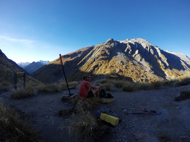
At the top of Rees Saddle
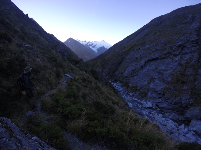
Descending along Snowy Creek
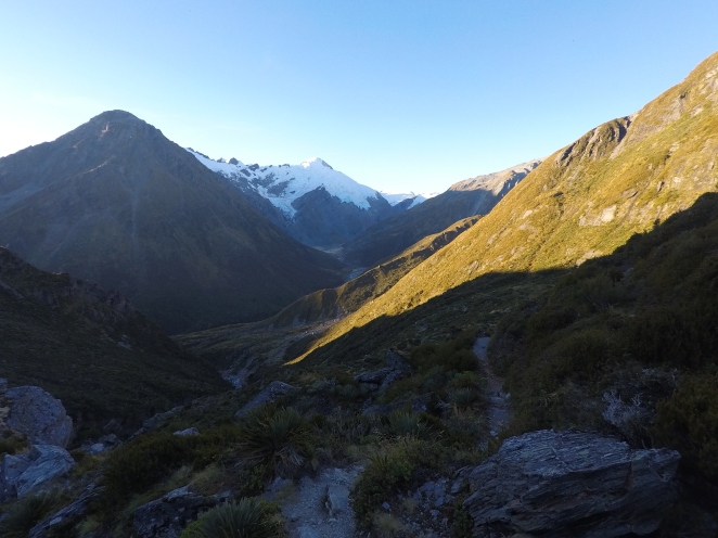
Dart hut was large and really nice, with flushing toilets outside AND some familiar faces waving at us from inside – Jaysen and Max! We filled them in on our plot, and they agreed. We decided we’d all base-camp at Dart Hut and do a day hike up to Cascade Saddle the next day, then walk the rest of the way in opposite directions the day after.
The walk up to Cascade Saddle was incredible. It started with a gentle climb along the Dart River to Dart Glacier, the source of the river. This was the first glacier I’ve seen up close, and it was so cool. As we were walking toward it, I kept hearing rumbles and cracks, and I thought a storm might be heading our way. Ben listened a few times and assured me that it was probably just “glacier sounds.” Once we got closer, it became more clear that these were just the regular sounds of the huge ice formation. Really eerie!
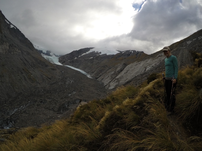
Dart Glacier!
From there, the climb got much more intense, winding and switchbacking up the side of the mountain. The view at the top of Cascade Saddle was well worth the climb, with a view of the glacier and Dart River on one side, and Mount Aspiring Park on the other side. Unfortunately, the top of Mt. Aspiring was hiding in a cloud, but that didn’t make the view down into the valley any less amazing.
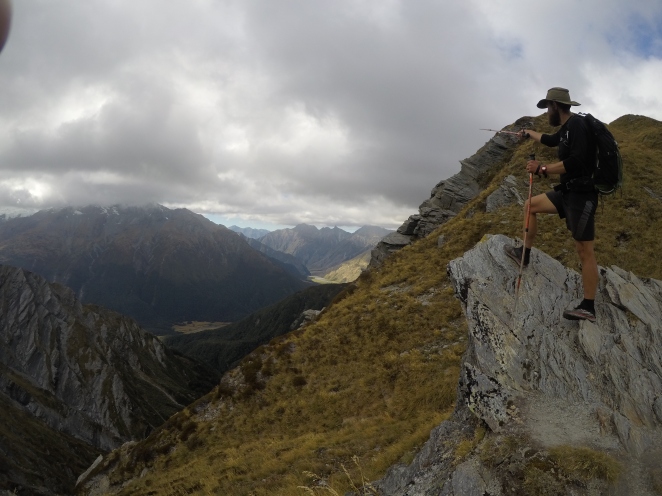
At the top of Cascade Saddle
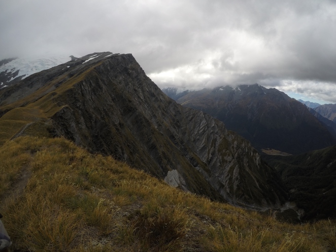
Top of Cascade Saddle
The day trip up and back also racked up a few more points on our “New Zealand Bingo” card – it was the first time seeing some really cool NZ wildlife up close! First, on the way up, we were followed by a group of Kea, a high-altitude parrot. We saw a few of these near Arthur’s Pass, but they were just ripping apart someone’s car. These ones were more in their natural mountainous habitat, just looking for opportunities to rip apart our packs. These birds are incredibly intelligent and bold, and have become something of a pest in really touristy areas because they’ve learned where they can find food. Despite their naughtiness, they are beautiful, cherished, and heavily protected in the country, and unfortunately the influx of tourism hasn’t been great for the species.
We also saw a Weta, a really strange-looking grasshopper-like insect endemic to New Zealand. As you can see in the photo, it was just chilling next to the trail on a tissue that someone had apparently dropped. I took the photo, and then had a fairly significant moral dilemma trying to decide whether to leave the Weta undisturbed, or try to sneak the tissue out from under it to throw it away. Whatever you think was the right decision, I probably did that. 😉

The Glacier AND a Kea (in the middle, a little below the ice in the photo)
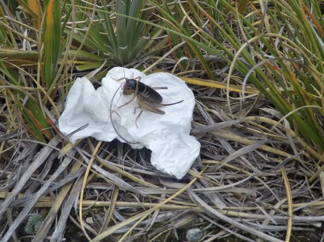
Weta
The wind picked up and it started to cool down, along with some mist here and there, so we made our way pretty quickly back down to the hut. We enjoyed chatting with some other hikers that night – a group of 3 made up of an American, a Canadian, and a New Zealand local. The local girl told us all about her job as a Kiwi Ranger – she works to help track the breeding habits of the Kiwi (birds) in a specific area and take measures to make sure the babies are protected and can grow and thrive. One more successful measure was actually removing the eggs from the nest to incubate them and raise the babies until they’re big enough to be able to fight off things like possums and stoats. I got a little sad about the babies being taken from their mothers, but she reminded me that an incubated baby Kiwi is better than a dead baby Kiwi! Part of the reason kiwis are so endangered is because Kiwis just don’t reproduce very often and babies are pretty much defenseless for the first several months of their lives. Their predators, on the other hand, tend to reproduce rapidly AND have no natural predators of their own.
The next morning started out a little wet and cold, but the sun later came out and warmed things up. The trail was super easy going along the Dart river valley until we got to the point of the trail that was damaged from the land slip. In many areas, you could see where the original trail had collapsed into the river, as we were working our way along a really rough, rooty, new “TA-style” track navigating lots of fallen trees. We tried to move fast, though, because we didn’t want Jaysen and Max to have to wait for us for forever with the car.
It was actually really cool to see where this massive slip had occurred. The natural disaster had actually created this really strange, beautiful landscape. The river was almost lake-like in some places, where deadened trees still stood tall out out of the bright blue water.
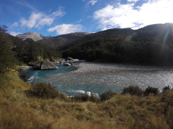
Dart River
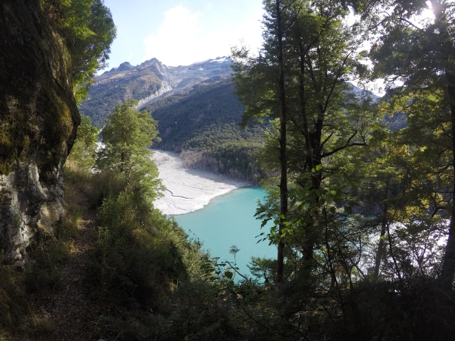
After about an hour, however, we got back on the original, well-maintained, flat trail along the river and soon we could see the small carpark from a distance. Once there, we waited for about an hour, reading our books and swatting away sandflies, until we heard our rental car coming down the rough gravel road blasting country music, which I believe was Max’s new obsession at the time. We drove the hour or so back to Glenorchy, where we dropped off the guys with a friend they knew there. We said “see ya later” because we invited them to spend some time at our AirBnB in Te Anau.
Ahhh, sad thing: I just had to really think about where we stayed that night! The specifics are fading so hard, which means I need to hurry up and finish writing these stories! But anyway, now I remember: Ben and I drove back toward Queenstown where we set up camp in a DOC campsite – 12 Mile Delta. We thought about going into town to get food and beer, but decided that we should keep eating all the trail food that we had purchased the week before, since we had already decided to skip the final Fiordland hike we had planned. Because the days were getting shorter, the nights colder, and the weather more unpredictable, we decided instead to spend a couple more days playing tourist!
