Hello, summer? Is that you??
Our first week on the South Island has been AMAZING! We’re loving the mountains, and the weather seems to be settling down and feeling more like what summer is supposed to feel like.
Queen Charlotte’s Track
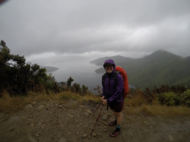
We started our South Island journey with short cruise from Picton up to Ship’s Cove, where the Queen Charlotte’s Track begins. This track is popular for hiking and mountain biking, so the path is very well-maintained and wide. It runs along the coast along the Marlborough Sounds and boasts tons of amazing views of the bays.
We had gorgeous, warm, and clear weather for our first day and we enjoyed plenty of ocean views and hiking time with friends. Ben and I set up camp by 5pm that evening alongside the trail, and we spent a pleasant evening relaxing, reading, eating dinner, and warding off Wekas with our tramping poles. (Wekas are funny and mischevious little flightless birds that have become accustomed to tourists in some areas… food is their favorite, but they love to sneak up and steal any little things they can run away with!)
The next morning, we woke up to rain. We walked all morning in the rain, and we walked all afternoon in the rain, and we stopped at whatever shelters we could find along the way to have our coffee, snacks, and lunch. The forecast didn’t look any better for the next two days, so we put in a long day (40km) to reach the last campsite on the track so that we could have a short walk into town and to a cabin the next day. We camped with and shared our wet, cold misery with other TA hikers that evening.
The next day turned out to be a beautiful day, but we reached the town of Havelock and enjoyed a night in a cabin anyway. We sadly realized that the Lifeproof case on our phone wasn’t so life-proof anymore, so we made plans to hitch to the larger city of Nelson the next day to get our phone dried out and repaired… for the 2nd time on this trip.
The Richmond Ranges
With a (mostly) working phone, we hitched our way back from Nelson to Pelorus Bridge, where we picked up our resupply box and walked about 15km before pitching our tent near the trail.
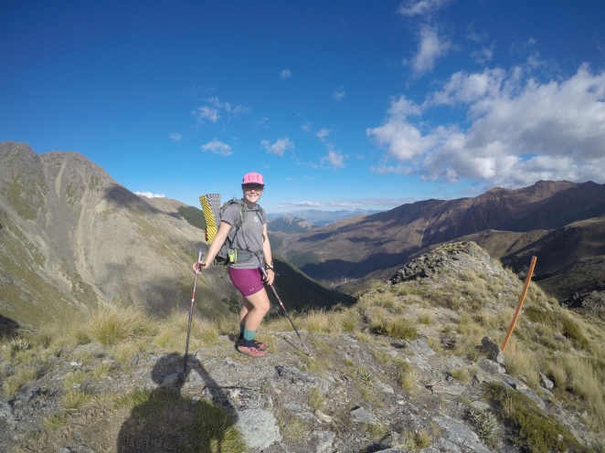
The next 2 long days of hiking were along the Pelorus River track leading to the Richmond Ranges, which have quite the reputation for tough tramping. The tracks were nice and dry and the weather was beautiful, and the forecast looked like we’d have several days of sun! We’ve started to meet several NOBOers, or North-bounders… TA hikers who started at the southern point and are hiking North. We’ve actually met a number of New Zealanders doing it this way, many of whom are only doing the South Island. It’s been fun to meet more hikers and to hear their stories about what we can expect!
And then… the Mountains! Because of the clear weather, we’ve finally been able to get some clear views… mountains on mountains…. mountains for days! The hiking through the Richmond Ranges was certainly tough with lots of big climbs, and lots of ups and downs. It was also the longest resupply stretch we’ve had so far, so our packs were heavy with about 6 days worth of food.
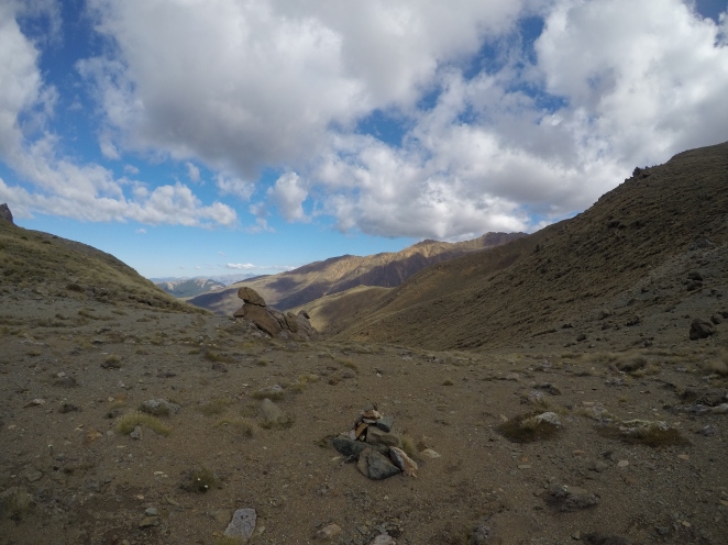
I’d try to pick some highlights to talk about, but this whole section was a huge blur of a highlight. The first day that we climbed up to 1500 meters was amazing because we spent much of the day walking along ridges with a clear view in all directions. The next day was a physically and mentally intense day with two challenging back-to-back summits of Little Rintoul and Mount Rintoul. To climb up to these summits, we had to do some rock scrambling up and then basically slide down scree slopes to the tree line. (In New Zealand, we rarely “hike” our descents… more like we slide down the mountains as controlled as we can. On the North Island, it was mud…. so far on the South Island, it’s loose rock!). Unfortunately our day of summiting these mountains was the only cloudy day, so we couldn’t see much from the tops, but the physical challenge of the day kept us pumped up! Our last day and a half of hiking in the Richmond Ranges were also amazing as we turned and got a totally different landscape – that of red rocks and desert-like flora.

This morning, we hiked about 5k to the nearest road and hitch hiked to St. Arnaud, a little mountain tourist town that’s a gateway into the next National Park we head into: Nelson Lakes National Park. We picked up our resupply box that we sent to the Alpine Lodge, and they’re wonderfully letting us charge our devices and use the computer. Soon we’ll have some lunch here (we’re craving some veggies!!!) and then walk along the lake to the next hut or campsite. We’re looking forward to some more clear weather these next few days, and some more amazing mountain tracks — the Waiau Pass that we’ll walk in a few days tends to be a favorite for lots of TA hikers!
Sending lots of love from New Zealand!

It is so comforting and inspiring to read your words, Laura! Thank you for sharing your new adventures on the South Island. Wow, such gorgeous photographs, but I’m sure they pale in comparison to seeing it all first hand, and feeling the sun, and wind and rain surrounding you. You often use the word amazing to describe things, but I keep thinking how amazing you two are! Please know how much you are loved and missed and admired. Be safe! Mom and Dad Creswell
LikeLike